Bike Ottawa is pleased to announce that we have developed a new map that shows you what routes are plowed in winter.
This map combines many data sources. We started with City of Ottawa open data about plowed sidewalks and paths, then added routes that are known to be plowed by OC Transpo, educational institutions, and businesses. Now, we’re launching a way for you to directly edit the map and add your local knowledge, too.
NOTE TO PLANNERS AND DECISION-MAKERS: This is a good-news story. But, the very fact that we resorted to creating this map (spending hundreds of volunteer hours, thousands, if you include our street-level photography) goes to show that there is a segment of Ottawa residents whose winter mobility needs are extremely under-served. Please help us put more blue lines on the map, and make getting around in winter without a car that much easier.
Whether you drive, walk, bus, or bike, getting around in winter can be difficult. However, people who bike face a particular challenge.
- Is it that biking is dangerous in winter? No!
- Is it that you get too cold? No! (if anything, too hot).
- Is it the short days and riding after dark? No! (though sometimes it’s a feat to keep all the lights charged up).
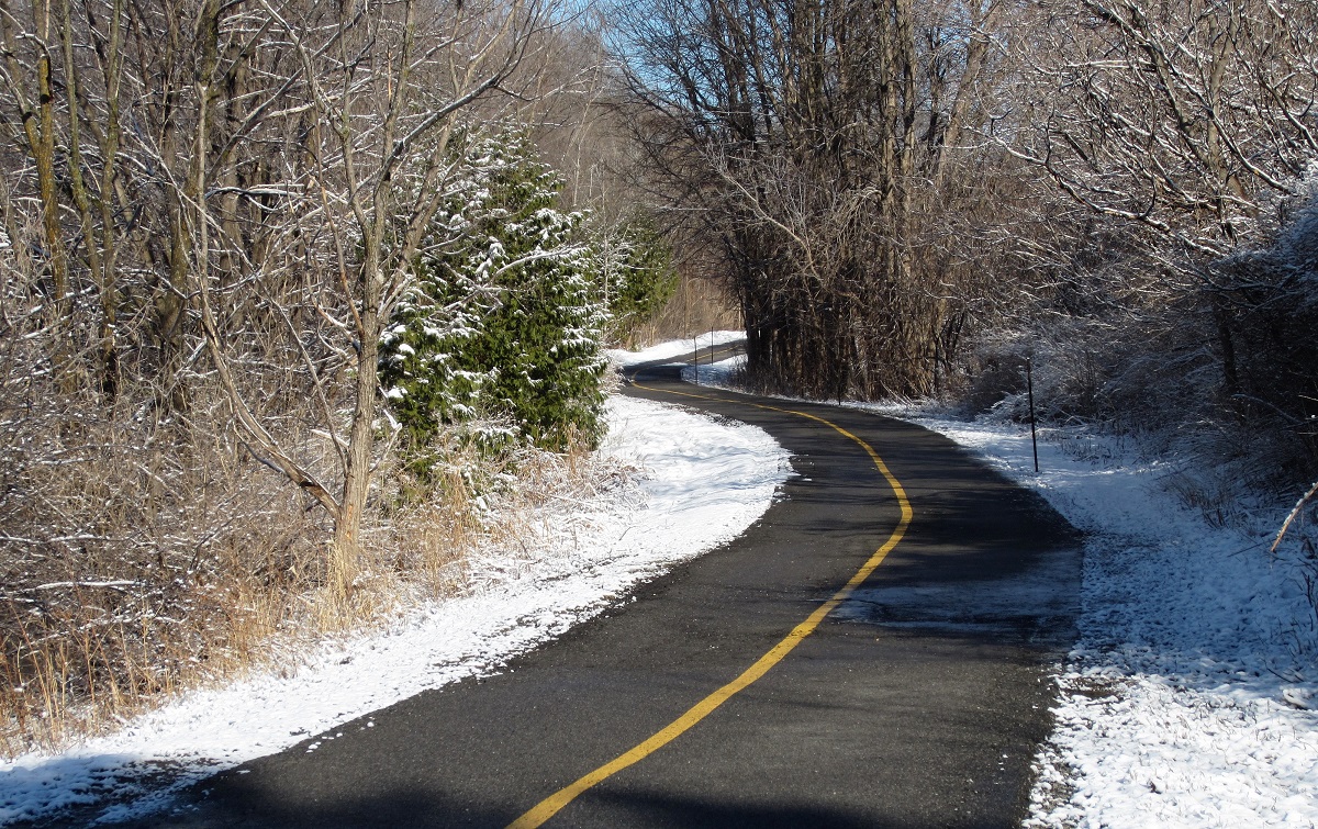
The unique challenge of biking in winter: many of the best routes disappear under thick snow from December through March.
A map of what is plowed is a necessity for planning winter routes. You’ll be able to avoid busier roads, find cut-throughs that you might not need in summer when better ways are clear, and take advantage of the side streets. With the right route, winter cycling is a very enjoyable way to keep building exercise and time outdoors right into your daily travels.
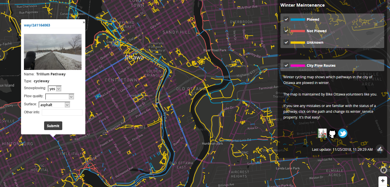
LINK TO OUR WINTER BICYCLING MAP
What this map shows
The map shows three things that are key to getting out in winter:
- Whether a path or cycletrack is supposed to be plowed, including city of Ottawa plow routes.
- Whether a path or cycletrack is known to definitely never be plowed, ever.
- For the adventuresome and curious among you, it also shows where we aren’t sure if a path is plowed or not. So go explore. You may be pleasantly surprised, but, assume that those aren’t plowed, either.
What this map does not show
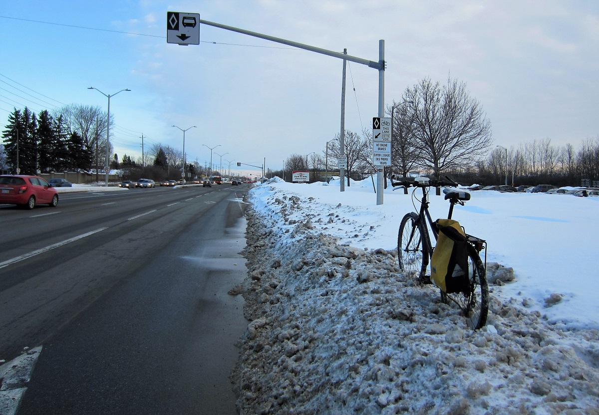
- Painted bike lanes. We aren’t displaying painted bike lanes here, for a few reasons. Being on the road, they are usually partially plowed. That is difficult to quantify, though… how much width needs to be cleared before you’d call the bike lane plowed? 80%? 50%? Also, how much width is cleared can vary greatly over the course of the season, or within just a few metres as you ride along the road. In short, conditions of on-road bike lanes are unpredictable, and so you’d need to be prepared to ride in the more travelled road lanes at any time, anyway. Varying conditions don’t lend themselves well to a static map such as this.
- The quality of the plowing. As above, variable conditions are tricky to map. It can be done, but for now we are focusing on whether a route is plowed at all. How well or how quickly it is plowed is a potential future level of sophistication. Your input may help.
- What is actually plowed. These are the routes that are supposed to be plowed. Reality may differ, sometimes because part of the route got missed, and nobody reported the oversight. So, if the map says something was supposed to be plowed, but it hasn’t been, submitting a Service Ottawa report is usually the way to go. But remember that the City of Ottawa is only one player – there are also businesses, the NCC’s subcontractors, schools, and OC Transpo, to name some others.
- The best route. Finding an ideal winter route can take a lot of trial-and-error. This will help you get started. A winter routing map (which will also include on-road segments) is a likely future project for us, once we have a good understanding of the plowed paths.
Useful data for winter bicycling advocacy
You can probably see already that this map contains a lot of information. Some neighbourhoods are fortunate to have their paths plowed, others are not so lucky. Why are some areas not served? Is there a policy that guides this? Bike Ottawa will be able to extract information from this map about what is really plowed in winter, and whether services are being deployed equitably and consistently across the city. We’re hopeful that examples of neighbourhoods that see extensive plowing will help us advocate for better service in the areas that need it, to bring them up to the same standard.
Furthermore, by seeing all of this information in one place, we can begin to develop a picture of the real missing links in our winter network. Sometimes, just a little bit more plowing can take you a long way.
You can also see that there is a lot of information missing from this map. For every yellow line on the map, there is a clear and simple answer of whether that path is plowed or not. Now, all we need is for someone who knows the answer to tell us what that path looks like. Read on…
How you can contribute
- Take photos. Notice how, when you click on a segment in the map, a photo pops up? Those photos are all sourced from local people, using equipment that is no more specialized than a GPS-enabled cell phone or action camera. If you contribute, your photos will be added to the repository, and lots of people will be able to use them to improve the map. Winter photos are especially valuable. To contribute, just sign up for an account with Mapillary, take some photos, and upload them. Grab those sneck-down images, too, and photos of snow mountains blocking paths. It’s very satisfying. For best results, take a series of photos moving through a space during daylight hours.
- Tell us what you know! We’ve set up a fun feature here to help us collect local knowledge. With our easy interface built right into the map, you can tell us what you know about paths in your area. Just click on any segment in the map. You will see drop-down menus where, with just a few clicks, you can submit information and help build the map. You will directly make real-time changes to the underlying Open Street Map, and they will be shown the next time the Bike Ottawa winter map is updated, typically within 24 hours.
- Tell us whether a path is plowed or not.
- Viewing the photos that pop up, or your own knowledge, you may also be able to tell us what the path is surfaced with.
- If there’s something else that you’d like to tell us about the map, submit a comment, and it will go to our mapping team for review and any necessary map editing.
So, please enjoy using these maps, participate in helping us develop them, and most of all, get out there and try taking a spin on your bike this winter (here are some tips to get you started). Good winter maintenance makes it easy.