Skip to content
Bike Ottawa

Bike Ottawa

Advocacy and Events in Canada's Capital Region

  • Home
  • About
    • About Bike Ottawa
    • Board of Directors and Working Group Chairs
    • Policies
    • Bylaws
  • Cycling Maps & Route Planners
  • Blog
  • Resources
    • Tips for Bike Activism
    • Reports
    • Documents
    • Cycling Laws in Ottawa
  • Newsletter
  • Get Involved
    • Volunteer
    • Donate
  • Become a Member
  • Community Calendar
  • Contact Us

Category: Data Group

Updates on the work of our data group

map tools

Launching: Interactive bike maps!

Posted on 2018-04-152020-02-24 by Bike Ottawa in Data Group, News

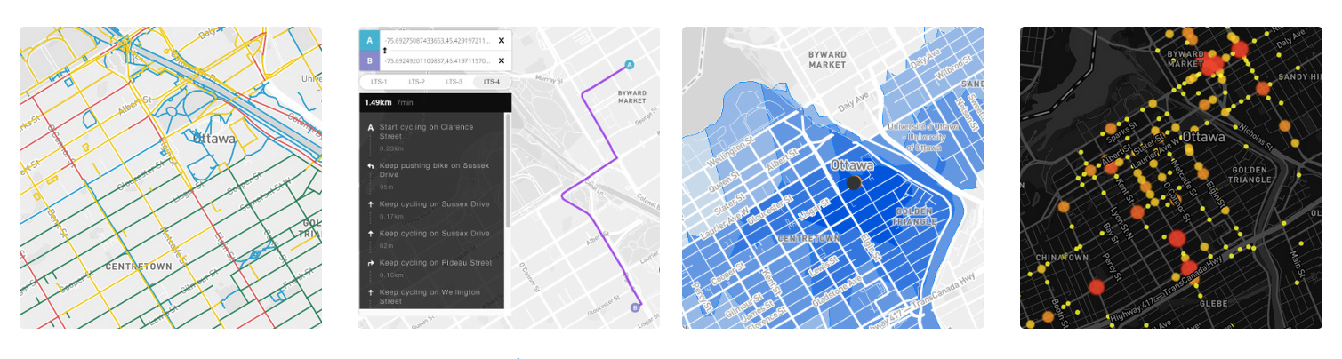
Bike Ottawa is pleased to present our newest website feature: interactive maps. These were made possible through the work of the Bike Ottawa Data Group, and supported by councillor Jeff Leiper.

mapping OSM

Can you help us count the number of lanes?

Posted on 2017-12-012020-02-24 by Bike Ottawa in Data Group

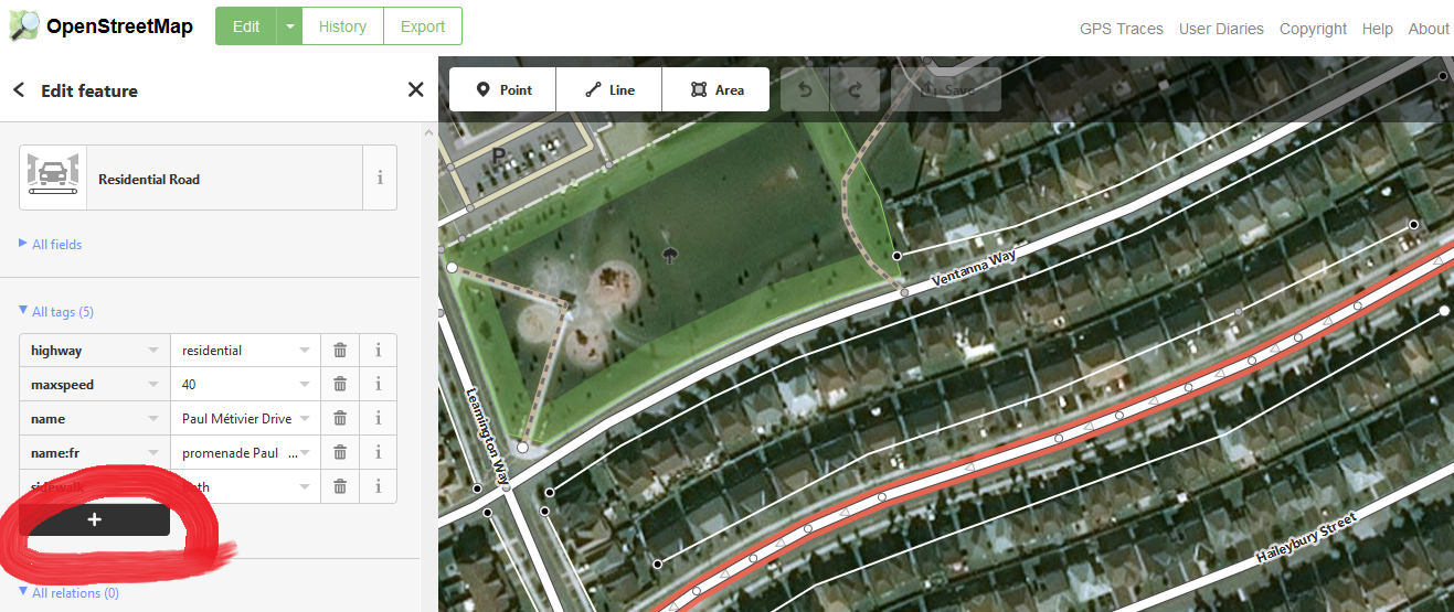
Welcome to the Data Group! Here’s a simple task to get you started with Open Street Map (OSM). We’re going to go looking for any roads that don’t have an information tag to tell us how many lanes thay have. And then add that information by editing OSM.

Mapillary Bicycle Capture

#CompletetheMap: A photo-mapping challenge for Ottawa

Posted on 2017-08-272020-02-24 by Bike Ottawa in Data Group

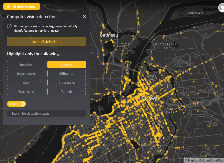
Bike Ottawa invites you to help map every path and road in the city using the crowdsourcing power of Mapillary and OpenStreetMap.

Posts navigation

Newer posts

Recent Posts

  • February 09 2026 | Newsletter
  • February 02 2026 | Newsletter
  • Bike Ottawa’s Take on Racks
  • January 27 2026 | Newsletter
  • Life outside of cars: Besançon

Categories

  • Bluesky
  • Email
  • Facebook
  • GitHub
  • Instagram
  • YouTube

Photos: GabesImages

Newsletter

Ensure you click the button in the confirmation email, otherwise you will not receive any emails.
© Zeko Theme by Anariel Design. Proudly powered by WordPress.