
Bike Ottawa invites you to help map every path and road in the city using the crowdsourcing power of Mapillary and OpenStreetMap.
What’s Mapillary?
It’s like Google Streetview, except that you can contribute to it yourself: shoot it today and see it on the map tomorrow, go map places where the Google car will never go – hiking and bike trails, urban pathways, rural roads, etc.
All photos on Mapillary are licensed under Creative Commons license and are free to use for Bike Ottawa future projects.
What’s OpenStreetMap?
It’s an open-source map of the world; anyone can edit it, and anyone can use the information to build useful apps for navigation and visualization. Start looking at the fine-print credits on some of your favourite map-based applications, and you’ll notice that OpenStreetMap is behind many of them.
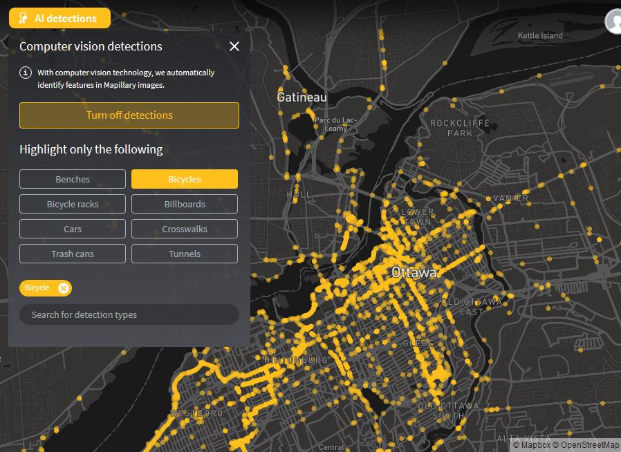
Mapillary is integrated with OpenStreetMap; Mapillary automatically detects features like traffic signs, and can even recognize objects like bike racks. These are then placed on OpenStreetMap to help map editors improve the map.
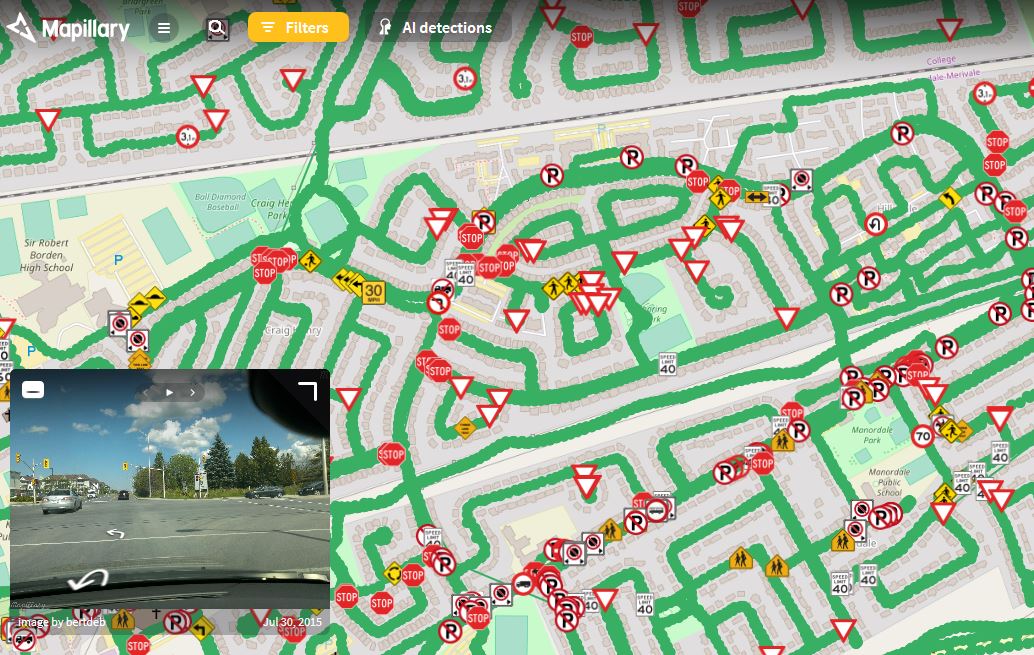
Bike Ottawa will be tagging features we are interested in: presence of bike lanes, road surface condition, bike parking, MUP width, winter plowing, and so much more. Many pathways are not even on any maps, so being able to maintain complete crowdsourced map of cycling facilities in the city helps to suggest and design adequate connected cycling routes to get around
Why do we need this?
- Use imagery to contribute to OpenStreetMap.
- Create a stress map of Ottawa streets that we can use for advocacy and route planning
- Show before-after views
- Explore how certain roads/pathways look in various seasons
- Point city staff and councillors to things that need to be fixed: dangerous roads, bad path surface, lack of signage, accessibility issues, etc.
- Check condition of out-of-town bike paths while planning long touring trips or just rides in Gatineau park or Greenbelt
- It’s fun! Bike Ottawa teamed up with Mapillary to start a challenge so you can compete with other mappers conquering the regions all over city. Check here for more details: https://forum.mapillary.com/t/completethemap-ottawa/1137
How can I contribute?
You only need a camera that can shoot every 2-5 seconds and record GPS location. Most smartphones can do that with the help of Mapillary app if you can find a way to safely attach it to your car, bike or helmet. If you have GPS-enabled action camera like GoPro5 or Garmin Virb Elite that’s even better – they are built with this kind of activity in mind. You can even use action cameras that don’t have GPS in them and attach coordinates later if you know how to do it.
See more information about Mapillary and guides here: https://help.mapillary.com/hc/en-us/articles/115001881105-Introduction-to-Mapillary
As you can see, we’ve already mapped a good chunk of Ottawa/Gatineau with the help of our volunteers, but remember there’s never too much data. East or West, Stittsville or Gatineau Park – the more photos we can get the better!
See you on the pathways!