
The city recently re-opened Montreal Road between St. Laurent and the North River Road to vehicle traffic in all directions. This 2km stretch of road cuts through the heart of Vanier and connects two future transit priority corridors (St Laurent & Montreal Road) to the NCC multi-use paths along the Rideau River.
Written by Dylan Trebels.
Overhauling this street is a huge accomplishment, and the value it will bring to Vanier, Overbrook, Manor Park, Wateridge Village and the east end of the city cannot be understated. Consultation for the project began in 2018 and the final project (cycle tracks and sidewalks) should be completed before the snow falls.
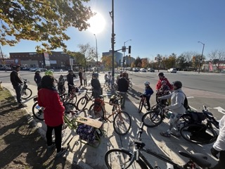
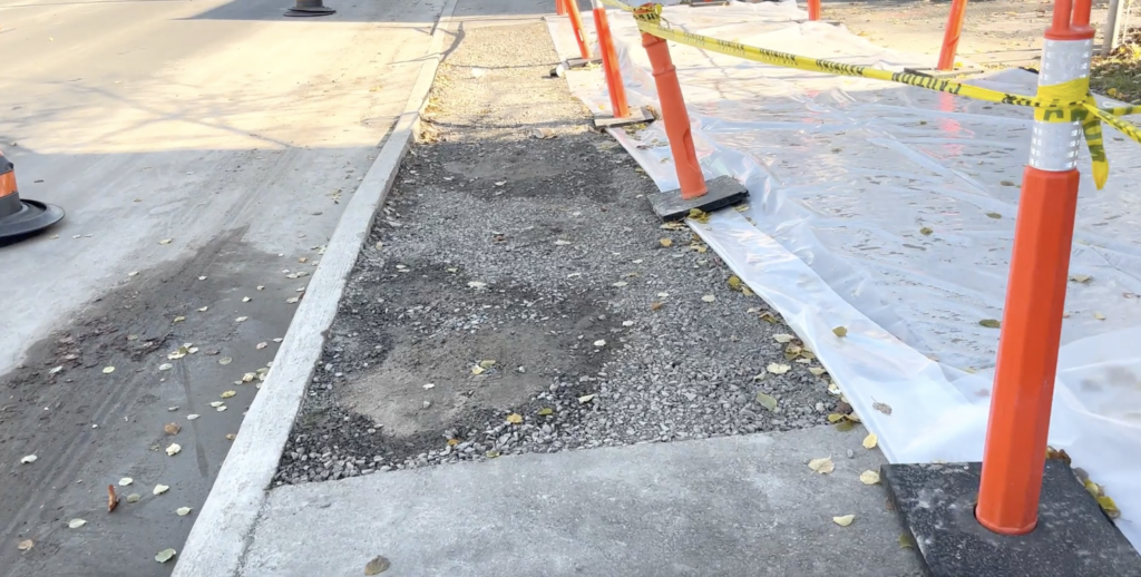
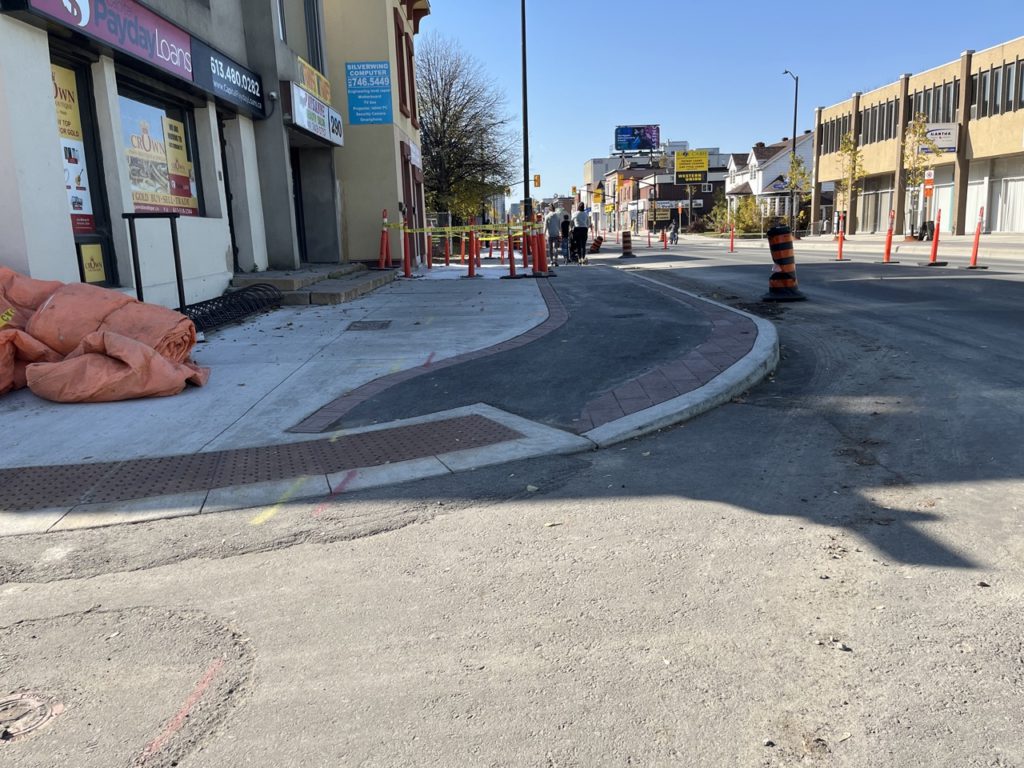
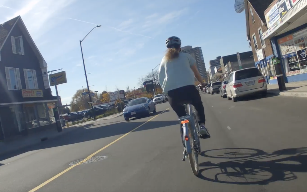
The project is far from complete for people who bike or use the sidewalk, but we were invited to ride the “open” portion with Councillor Fleury, and City Staff on Saturday October 22nd to look at the good, the bad, and the ugly of the redesign. We were unable to navigate significant sections between St Laurent and Ducharme. They were still very much under construction without any temporary detours for people on bikes or pedestrians. We would never accept a street being “reopened” to motor vehicles with multiple stretches still very much unfinished.
Here’s what we found:
Overall, this is a huge improvement and a step in the right direction for how the city approaches street redevelopment. This busy main street provides a key connection to some of Ottawa’s beloved “Bike Highways” along the Rideau River. Much of the redesign has removed street parking and given that space to pedestrians and active transportation. This is a welcome change. That being said, this redesign is not a gold standard, and in some cases is already out of date regarding accessibility standards. While it represents a significant improvement we would not consider it to be all ages friendly. There are too many conflict points with motor traffic and a few key safety concerns at the eastern and western ends of the redevelopment.
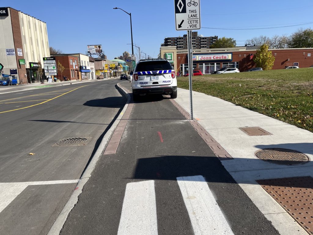
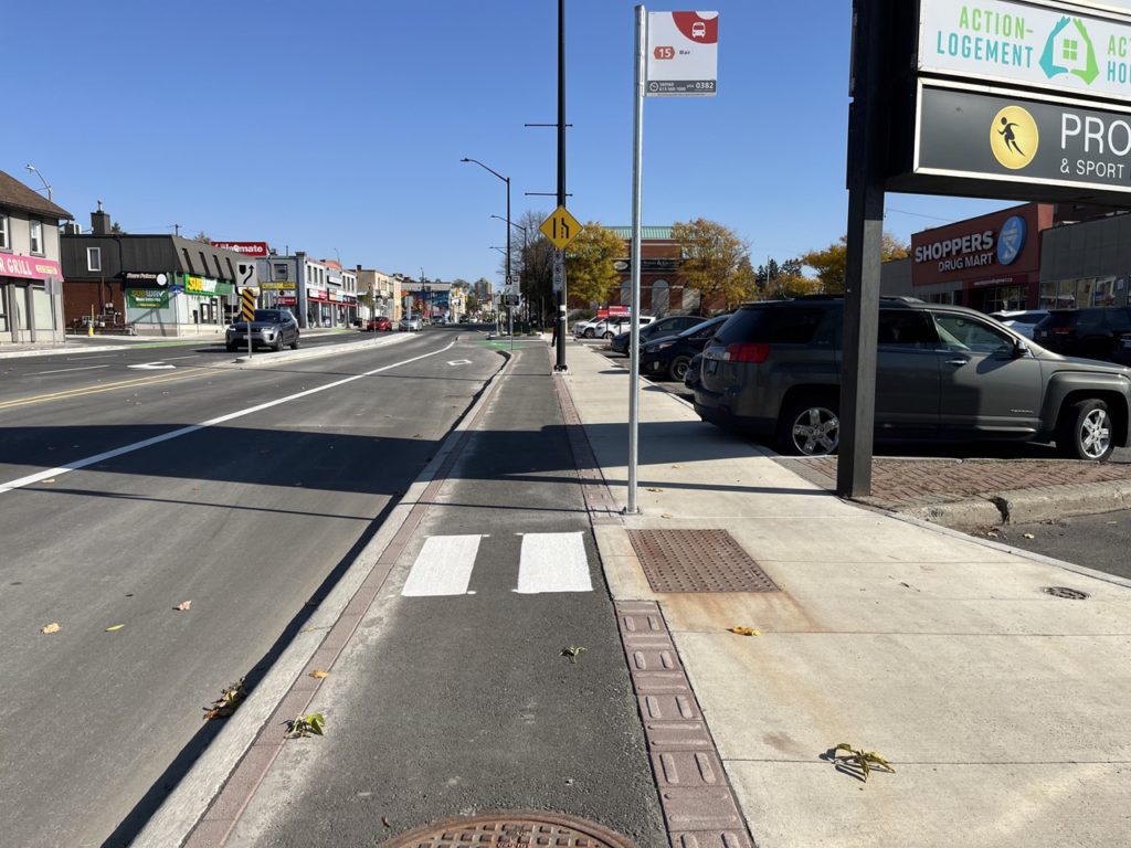
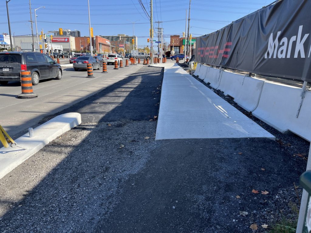
We’ll start with what’s good. The lanes are physically separated from car traffic which is a welcome change! It is significantly safer for all road users than sharrows, painted lines, or seasonal flex posts. It prevents conflict with street parking and a “dooring zone”, and also gives people on bikes dedicated space separate from pedestrians. That said, at the opening ceremony we saw a police car hop the curb to park in the brand new lanes, so far from perfect separation.
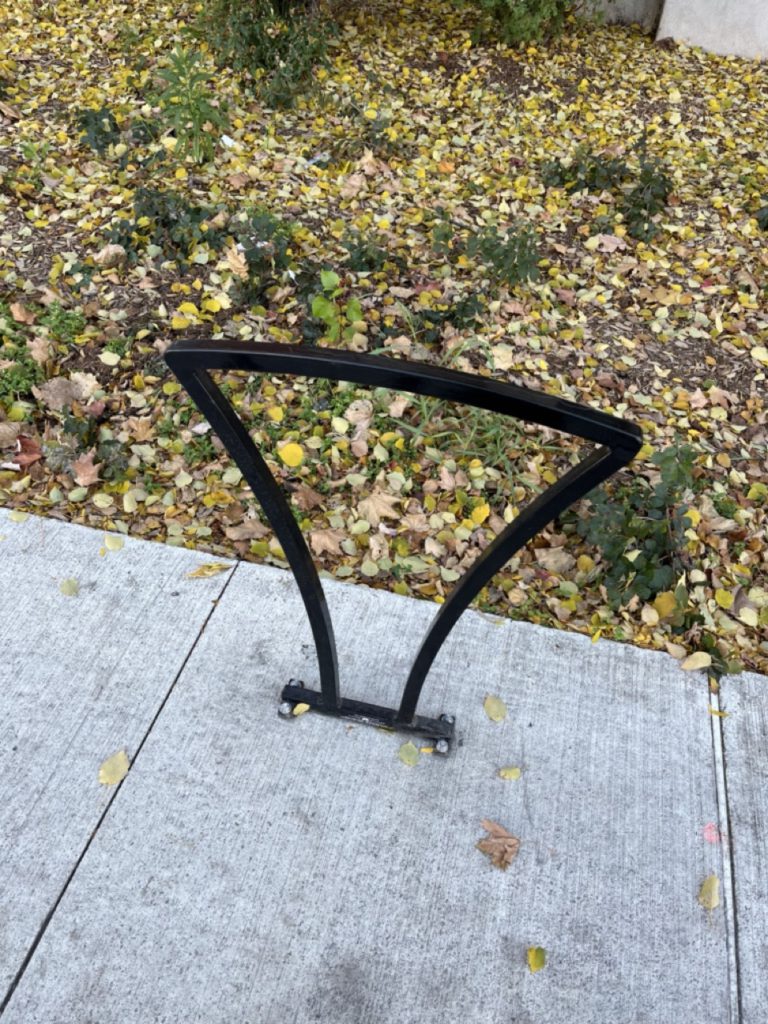
Also welcome are some of the upgrades to the general streetscape. Buried hydro means less poles obstructing sidewalks and lanes. The new staple style bike racks scattered throughout the redeveloped Montreal road are good but we have two minor suggestions for improvement here, it would be good to see even more bike storage available, and where possible it would have been ideal to see the bike racks cast into the concrete for greater security. A bike rack is only as secure as its anchor point.
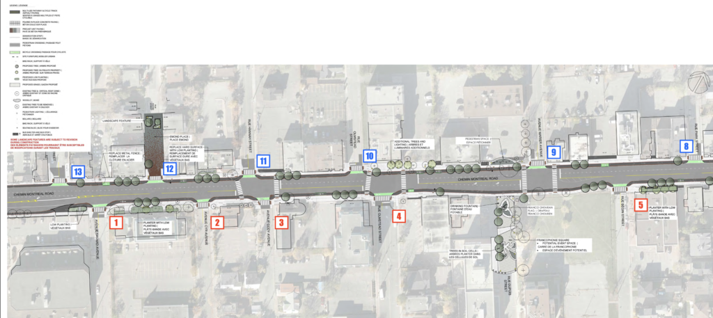
One element we want to highlight as an A+ is found heading eastbound near Ducharme Street. Here, the cycle tracks route behind the boarding for OC Transpo minimizing potential conflict. It’s an excellent use of space, and this best practice should be rolled out wherever possible on new streets, and street redesigns
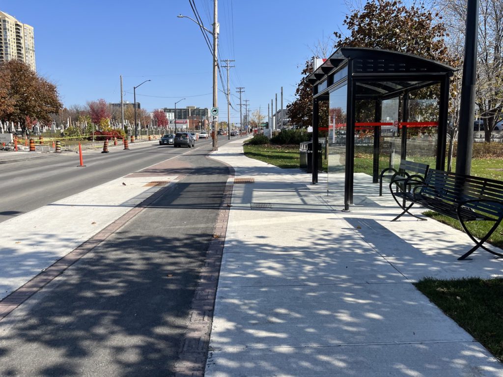
However, not all of the bus stops follow this practice. Many have the cycle track running right where pedestrians will be boarding and getting off the bus. People biking will be required to give way to pedestrians, however there will be foreseeable conflicts, as people wait for the bus in the bicycle lane, as often happens in this design. When we spoke with city staff they mentioned “space restrictions” as the reason they did not reroute all bike lanes behind bus stop waiting areas all along Montreal road.
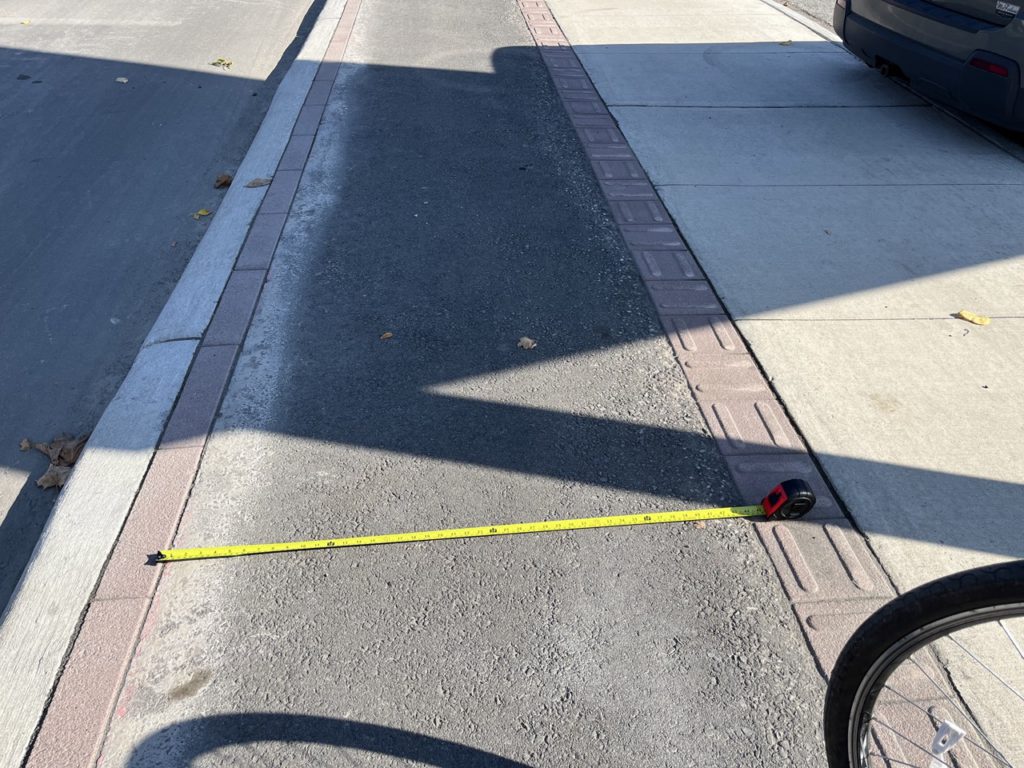
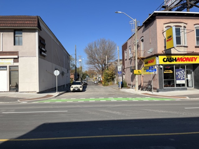
Now for the bad. While the majority of the cycle tracks meet the minimum 1.5m width, several street features like the tree planters encroach on this space effectively making them 1.1m wide. We broke out the tape measure at several points to highlight the issue. Bike Ottawa would prefer bike lanes be much wider to accommodate side-by-side riding, and wider bike lanes mean more space for snow storage when they are plowed in winter.
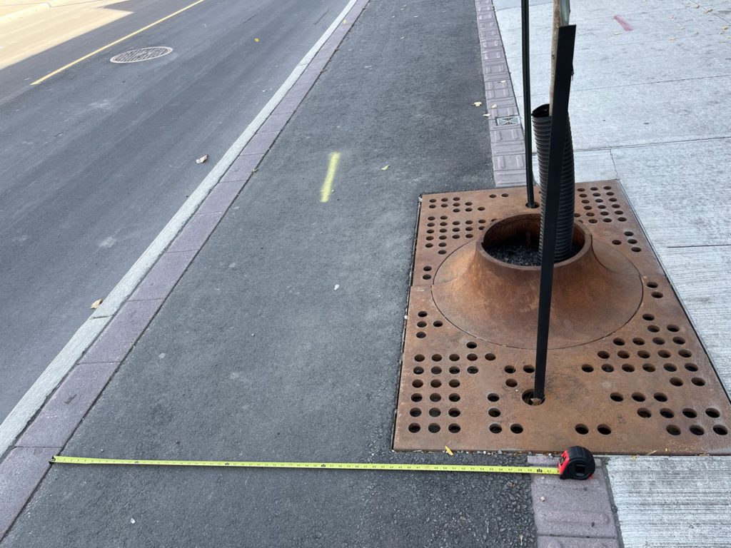
More street trees are a good thing. The issue is in the choice to take away space from already narrow lanes. The narrowing of the lanes also raises concerns for winter maintenance which we’ll be back to verify once the snow starts.
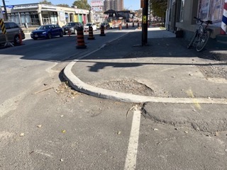
There is also a particularly narrow stretch near the Vanier Parkway that is only 1.1m meters wide, which does not meet minimum design criteria. Folks on cargo bikes and long tails will have more trouble navigating this stretch. The narrowness is compounded by several signs, and a bus stop. We were told the alternative was to have no cycling facility here as the city had to acquire land from the adjacent parking lot.
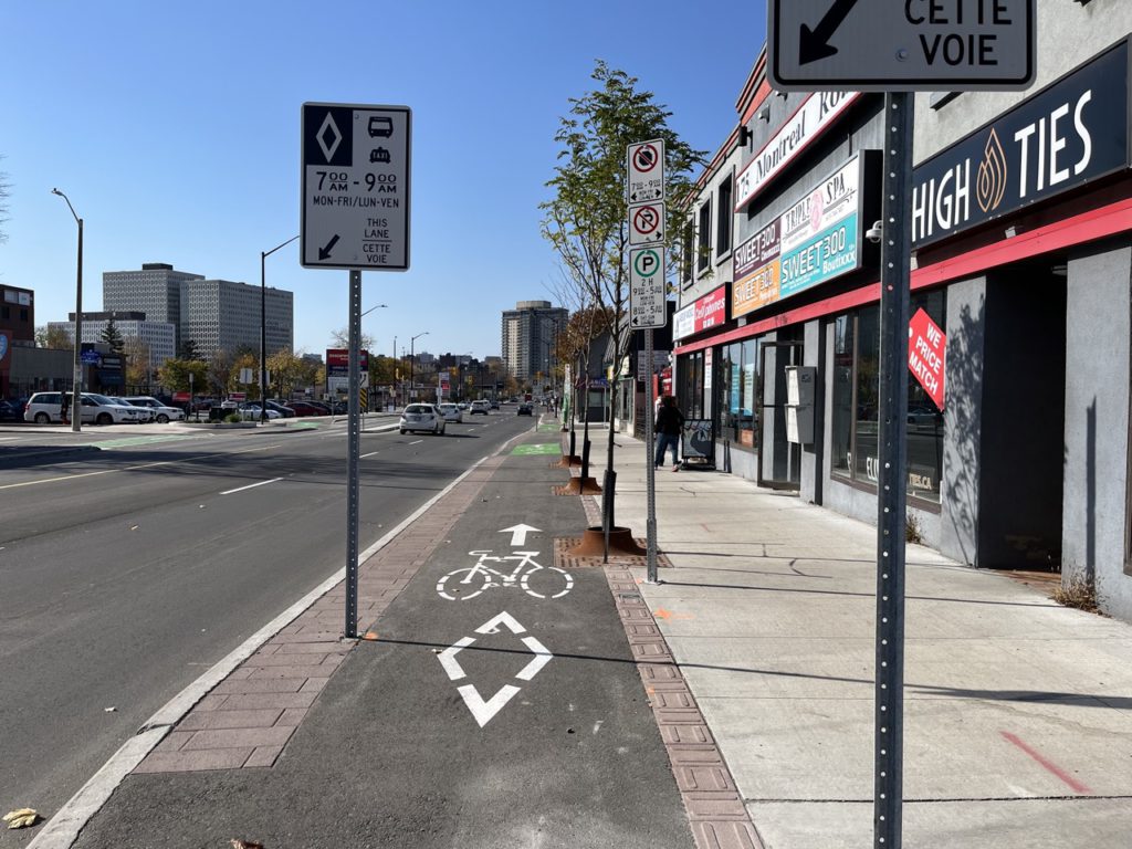
Along the route there are several pinch points due to sign placement and proximity to trees. The number of signs is excessive, and we recommend staggering and spacing these out all along the route to create less pinch points.
The entire redesign includes Tactile Walking Surface Indicators (TWSIs) extending across the cycle tracks at every minor intersection. It gives the impression that one might have biked onto the sidewalk, or into pedestrian territory. At the time this street was redesigned, extending the TWSIs into the cycle tracks was the accessibility standard. However, the new design standard has a half-height curb to separate cycle tracks and sidewalks. While the TWSIs are not ideal on a bike, we will say, riding over them is not as bad as we expected, and pedestrian safety comes first. Given that the city knows this is a suboptimal solution and has a new design standard, it would have been nice to see it swapped out before construction, but it was not, and they are there to stay.
Possibly the biggest critique we have in the “bad” category is the amount of potential conflict with motor vehicles along this route. On the 1km stretch between Ducharme and the Vanier Parkway there are 12 minor intersections eastbound, and 13 minor intersections westbound. At an average cycling pace of about 13km/hr that means potential conflict with vehicle traffic every 21 seconds. On top of that, the tracks bend slightly away from Montreal road, and dip down into the street crossing at every intersection. It makes for a “roller coaster” feeling as you’re riding.
We spoke to staff about two potential solutions which could still be retrofit into this design (on top of ensuring there are leading pedestrian intervals at crossings).
First is Continuous footways/bikeways. These are now part of the City’s design toolkit for 30km/h streets Bike Ottawa believes that this tool also has additional applications for minor intersections along a corridor like Montreal road.
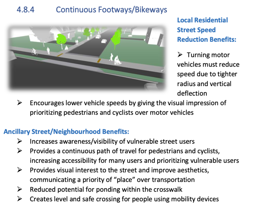
Today, there is no physical cue telling a driver they are entering pedestrian/cycling space. On paper this isn’t an issue, because cars should stop behind the line at stop signs and wait to go until it is all clear. However, in practice cars frequently roll the stop to creep out and make their turn onto Montreal road.
The current implementation has created a situation where conflict is inevitable, and there’s a lot of it. Continuous footways/bikeways alleviate this, by giving drivers no choice but to slow down. They also keep people on bikes, pedestrians, and folks using mobility devices at grade creating a more comfortable experience for vulnerable users.
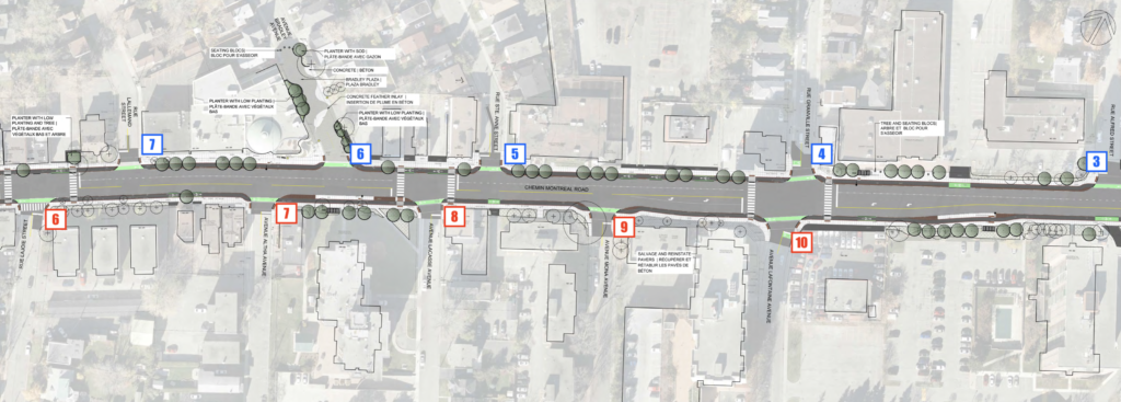
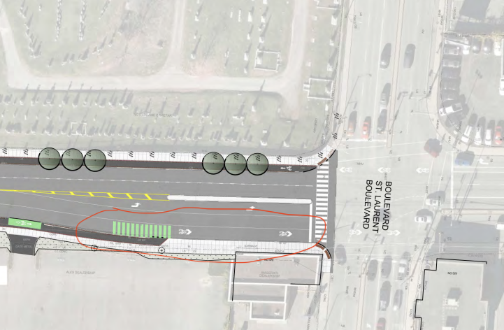
The second recommendation is traffic diversion – limiting car access to Montreal road from several of the minor side streets. The stated goal of the Montreal Road redevelopment was to create a “vibrant main street”. Unfortunately, the intersections with side streets every 50m makes this difficult. Take this 220m stretch as an example.
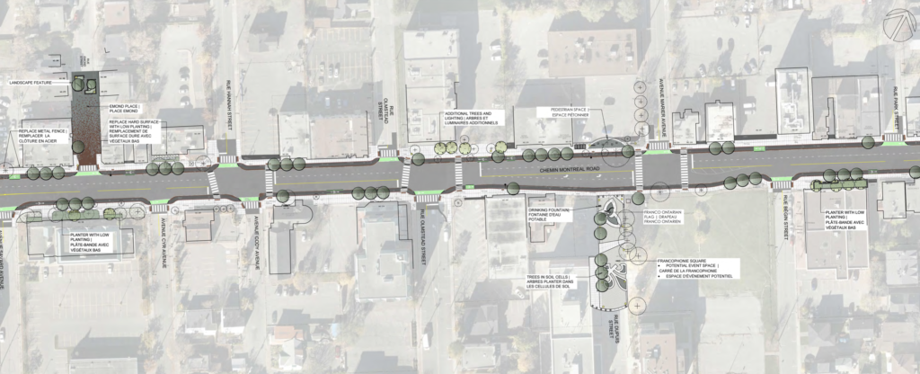
There really isn’t a need for all of these side streets to have vehicle access to Montreal road. They could easily be routed to Vanier Parkway or Montreal Road by way of Dechamps and Marier. This would reduce the number of conflict zones, create more placemaking potential, like the new pedestrian plaza on Edmond street, and have minimal impact on actual traffic flow.
Now for the Ugly. There are two main points we want to highlight here that are serious safety issues:
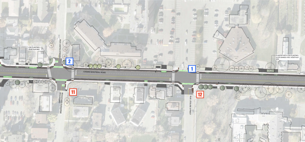
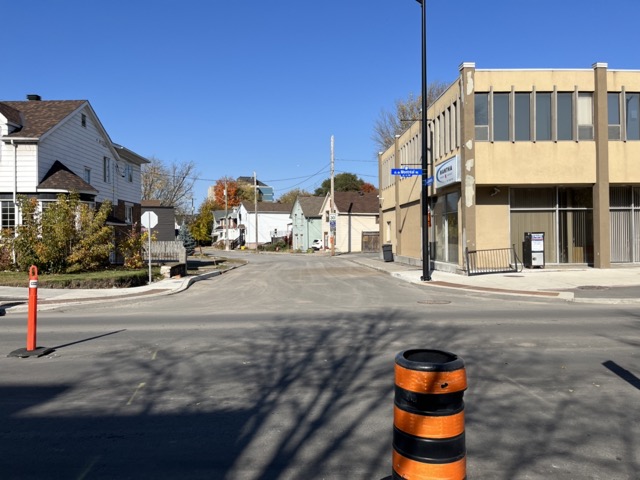
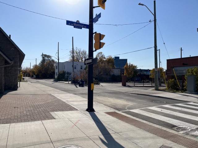
The first is Eastbound at the intersection near St Laurent.
Here you can see, the cycle track ends, and spits users out into the right turning lane which is marked as a sharrow. This is unsafe, full stop. The intersection of St Laurent Blvd and Montreal Rd is a very busy intersection. It bisects two future transit priority corridors, and sees lots of motor vehicle usage at all hours. Add to that, the fact that right turns on red are allowed at this intersection. Whether a person on a bike takes the lane or squeezes to the side, they will come into conflict with cars wanting to turn right. With no receiving facility on the other side of the intersection some people on bikes will squeeze over to the gutter creating frustration, confusion, and generally a bad time for everyone involved.
The St. Laurent Boulevard Transit Priority Corridor Environmental Assessment (EA) Study includes a protected intersection design here, however this would be years away from actual construction. This is a prime example of what happens with piecemeal approaches to infrastructure. Broken connections like this reduce overall usability, create conflict, and in particularly dangerous designs like this sharrow, may actually lead to injury. Regardless of what the design intent was here, the result is unsafe infrastructure.
Our recommendation for immediate remediation is to ban right turns on red for Montreal Road Eastbound at St Laurent and install a bike box for those who are brave enough to join motor vehicle traffic and wait in the street to cross. The change can be executed primarily by way of signal control. This is a band-aid solution, but we believe it necessary to prevent serious issues with what was built. That said, we believe most people will join the sidewalk to make the connection, as they will feel unsafe “sharing the road”with motor vehicles.
The second bit of “ugly” on this project is the lack of any safe infrastructure between the Vanier Parkway and North River Road. North River Road is the connection to the NCC Multi-Use Paths. This final 350m stretch is a key connection to the greater Ottawa cycling network. By providing no safe cycling infrastructure on it, the city has chosen to keep a key link broken. Both Bike Ottawa and the Vanier Community Association have been asking the City to provide this key link since the early planning stages, but the City has chosen to provide four lanes of vehicle traffic, citing “traffic back up” as the reason they could not reduce a lane, and provide cycle tracks the entire way. We of course disagree, and believe the safety and connection to the River pathway is crucial to people on bikes.
Instead, the City has decided to re-route people on bikes behind the Tim Horton’s onto Mark Avenue by way of a multi-use path.
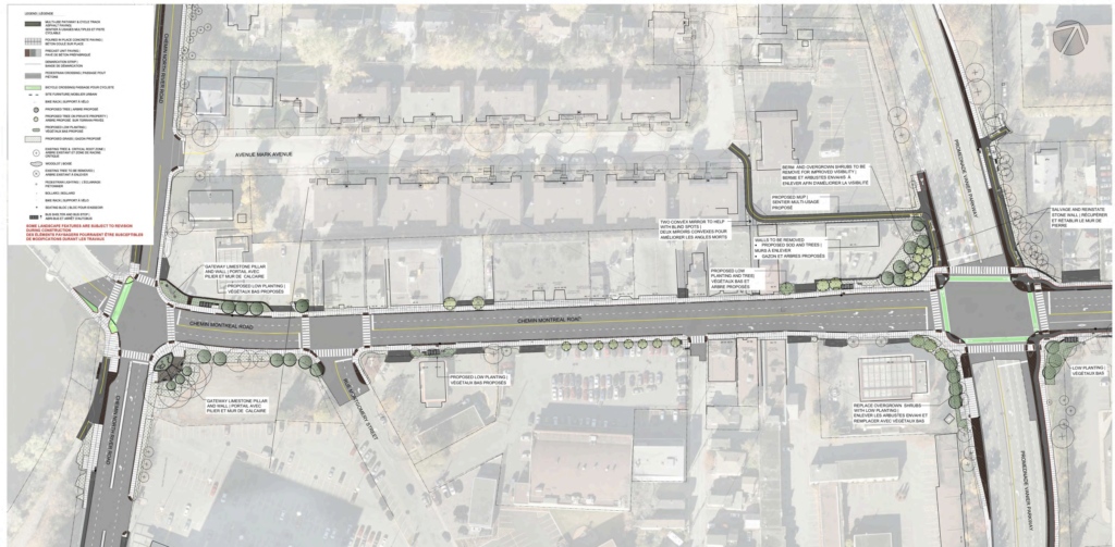
Unfortunately that is not intuitive and in our discussion there was some understanding that routing people on bikes behind a Tim Horton’s onto a residential street barely qualifies as a solution to the missing link.
If the city is serious about encouraging mode share shift towards active transportation we have to abide by the idea that the most direct path is what should be built for active transportation. People biking are not following Google Maps looking for a detour on their route particularly when the ultimate destination is 350 away and visible from the eastern part of the intersection of Montreal Road and Vanier Parkway.
Overall, we are incredibly pleased to see the engagement from the City and Councillor Fleury on this project. It was wonderful to celebrate infrastructure that residents, the community association, and so many others have fought for for over a decade.