
Did somebody say “improvements”?
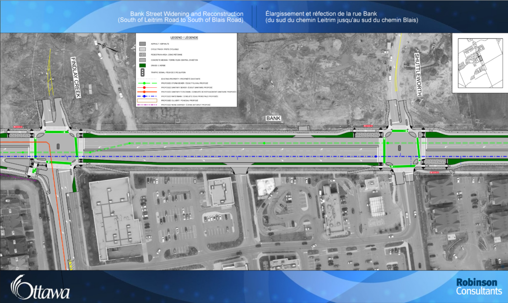
Call us nerds, but some of us do enjoy looking into the City’s projects, reading up on them, looking at the drawings and making suggestions. And a new one just dropped! This time the focus is Bank Street. That street, the longest in Ottawa, travels from Parliament Hill to the city’s southern boundary, crossing through multiple neighbourhoods along the way, among them Findlay Creek. There have been talks to widen Bank Street there for at least ten years, but the project was supposed to happen after 2031. The timeline has been accelerated due to successful lobbying from local councillors, with construction slated to start in 2024. This project is wide in scope and will have important consequences, both after completion and during construction, as it will happen from 2024 to 2026, with the street fully closed between May and December 2024. By the end of 2026 this section of Bank Street will have been turned into a bona fide stroad, a design urban planners have been rejecting for more than a decade.
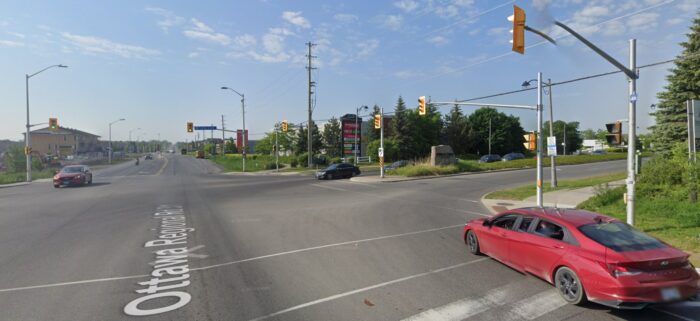
Despite being a very new community, Findlay Creek doesn’t depart from the usual suburban Ottawa neighbourhood: lack of pedestrian and cycling infrastructure, massive parking lots, car-centrism and all the dangers and problems that come with it (see this X/Twitter thread by Derrick Simpson). Will this project improve the current situation? Let’s find out!
With such a name (Bank Street Widening and Reconstruction), this project isn’t off to a good start. As always, it is frustrating to see this city default to widening the streets without any long-term plan. The Official Plan and its objectives (reducing the modal share of private motor vehicles, “aiming for a clean, renewable and resilient city”, etc.) are, once again, completely disregarded in favour of the immediate fix that only furthers Ottawa’s car addiction. Slashing public transit, prioritising cars, making roads wider, all of that leads to one outcome: increased car use. Which is bad for our wallets (owning a car costs on average more than $16,000 a year, and the City is spending $88 millions this year to fix potholes and resurface roads), bad for the city (more traffic downtown), bad for the environment. And in the long term this fixes nothing and will only lead to further frustration, as the widened street will draw more drivers in and lead to more traffic, sending us back to square one. The residents of that area deserve better than a short-term solution.
Nevertheless we delved into the project documents and shared our thoughts and remarks with the City’s project manager and the local councillor in a letter we sent last week.
Let’s start with the positive:
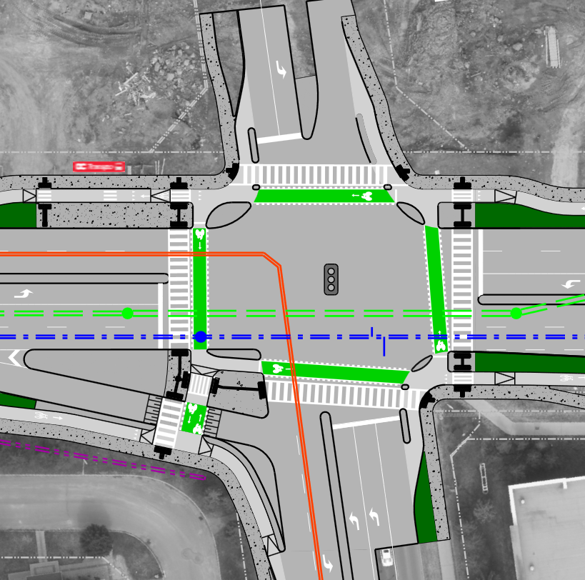
- Proper, separated, facilities for people biking and walking. This should be the norm and will undeniably make vulnerable road users safer.
- Protected intersections (warning: caveats to come).
- Raised and continuous crosswalks and crossrides at driveways and minor crossings, encouraging drivers to yield to pedestrians and people on bikes.
Unfortunately there’s also a lot to say on the negative side. Here are some of the most prominent issues we’ve noticed, in addition to the already mentioned blind headlong flight into traffic growth:
- Slip lanes. That type of infrastructure prioritises vehicle speed and flow over people’s safety and should be banned anywhere there’s people. When entering a slip lane, drivers are focused on the incoming traffic, looking left. Any pedestrian or person on a bike coming from their right is at a high risk of just being ignored and struck. And here we’re creating two new ones!
- The new facilities will exist in a void, disconnected from any other bike infrastructure. As long as people won’t feel safe on the full length of their bike trips, only the most hardened road cyclists will feel comfortable going anywhere outside of the neighbourhood.
- The project excludes the Bank/Leitrim intersection, despite the clear danger it poses. The subject was broached during the public meeting held on 23 January, and it appears this intersection is a separate project that may move forward during the Bank Street Widening. It is quite unfortunate to not have merged the two.
- Some intersections will be wider than currently, increasing not only the crossing distance but the potential conflict points.
To read all of our recommendations, check out our letter. And if you too want to have your say, consider reaching out to the local councillor and the City’s project manager (contact information is here).