
Last Thursday, the City held a planning workshop for the upcoming O’Connor St. Bikeway. The planners were interested in feedback from cyclists over its design. Although the project itself is interesting, so is the way in which the city engaged cyclists.
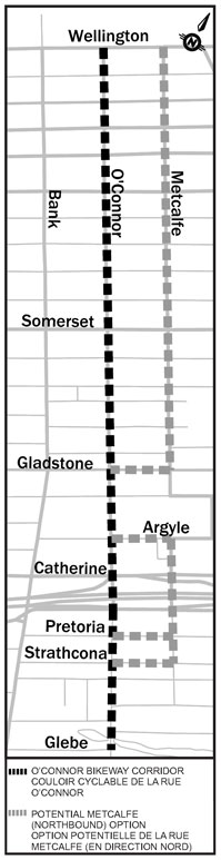
The project is the north/south connection between Wellington and Pretoria, but the Glebe neighbourhood bike plan will bring the route all the way to the Holmwood and Lansdowne Park. It’s been in the Ottawa Cycling Plan for years, and was talked about having segregated bike lanes well before Laurier’s were built.
Big change in approach
Many members (and a few from the board) of Citizens for Safe Cycling participated in a smaller introduction session last Monday night. What we were told was: this was about WHAT to do, not IF. This is a big change from where we were with Laurier in 2011. We spent 3 years advocating that the city would not fall apart if we did a 2-year pilot project.
The 80 attendees were first briefed with some basic assumptions: O’Connor would remain one-way southbound, we couldn’t move the curb lines, a road diet down to 2 lanes was acceptable, and remove parking if necessary.
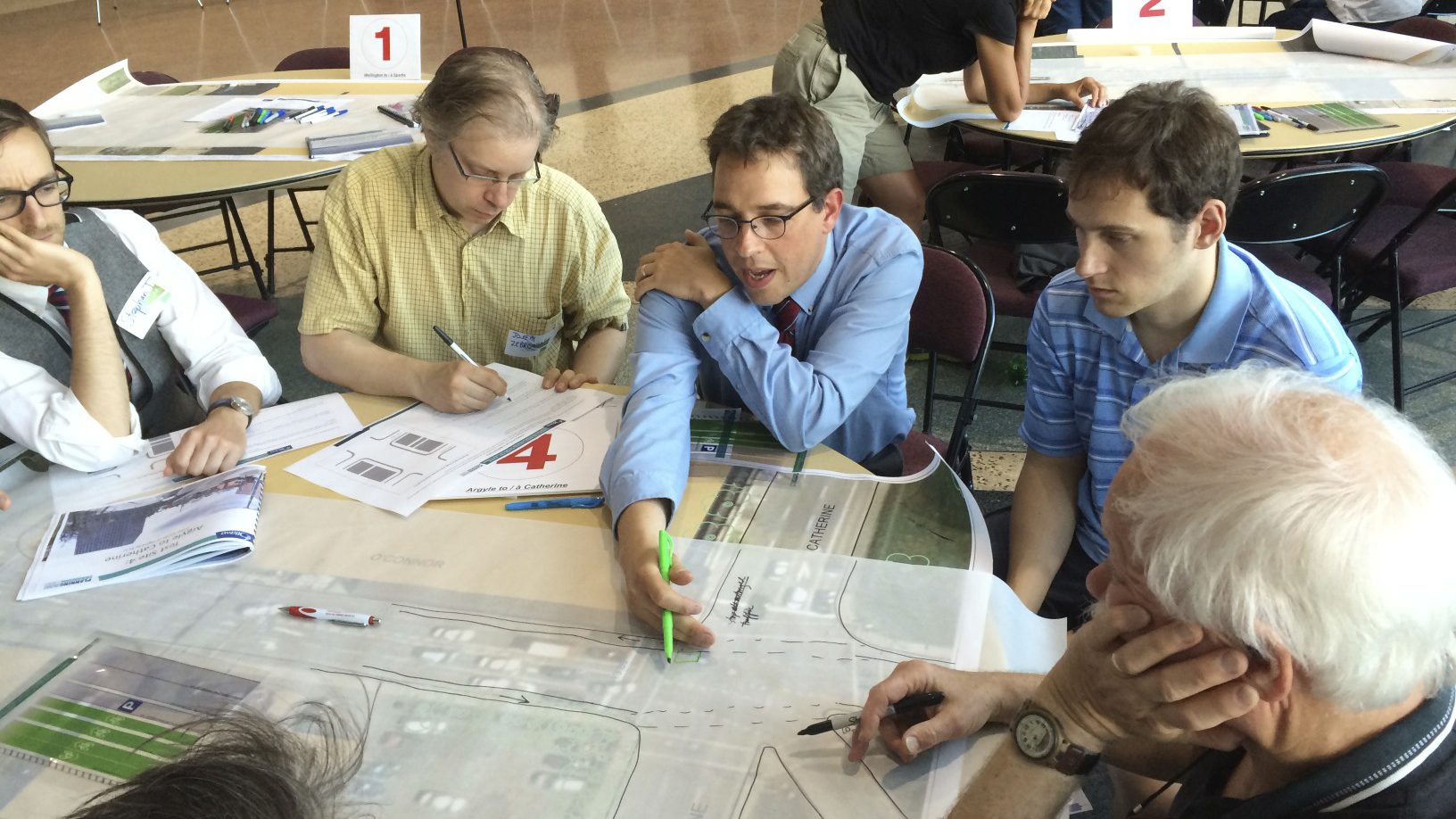
Then the crowd divided into about twelve tables which focused on one of five sample locations and drew posters with lane configurations. Few at my table had ever done amateur traffic planning, so it was quite fun. There was a table-sized blowup of the area to look at, and an onion-skin sheet to draw on, using markers, a bike lane template and imagination.
People asked questions to various planners and engineers hanging around, but largely ignored the OTM Book 18 reference.
Not many participants knew the details that would constrain the design: there’s a necessary car lane width that depends on speed, you can’t remove parking and it’s hard to convince signal engineers to do a bike-friendly green wave.
Coordination challenge
And of course, Ottawa being Ottawa, you always have to deal with a smorgasboard of parties involved. Just ask Jeff Westeinde who is trying to coordinate 7 different parties for his Chaudiere Project.
Co-ordinating with the NCC (which owns Wellington) and Ministry of Transportation of Ontario (which owns the 417) is pretty much impossible. And there’s nothing like the Ontario Highway Traffic Act to kill the buzz.
The groups posted their drawings so others could see. The session finished up with different groups explaining what was hard about the project and what they’d like to see done.
I hope one of the results of this is participants realizing how difficult it is to design bike infrastructure. Often, cyclists think it’s just a matter of painting some lines on the road. But it is much more complicated.
If you missed it, you can fill in the survey here.
Predictions
The fundamental problem with the bikeway is putting bi-directional bicycle traffic on a one-way street. You can split the directions across both sides, put bi-directional paths on the west side, but my prediction is bi-directional on the east side. Here’s why.
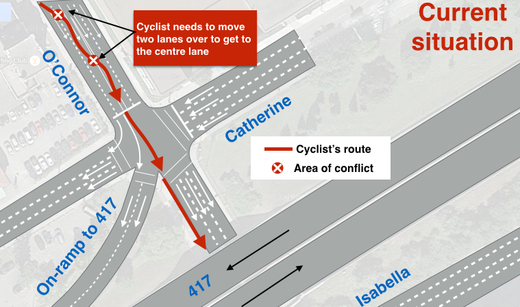
The worst part of the entire stretch is where O’Connor crosses the 417 and requires the most attention. Putting a southbound lane on the west side doesn’t deal with the current problem: getting cyclists to get to the middle of the road to avoid right-bound turns.
There’s a lot of traffic to negotiate during rush hour. Here’s the problem with the current layout showing the conflict zones:
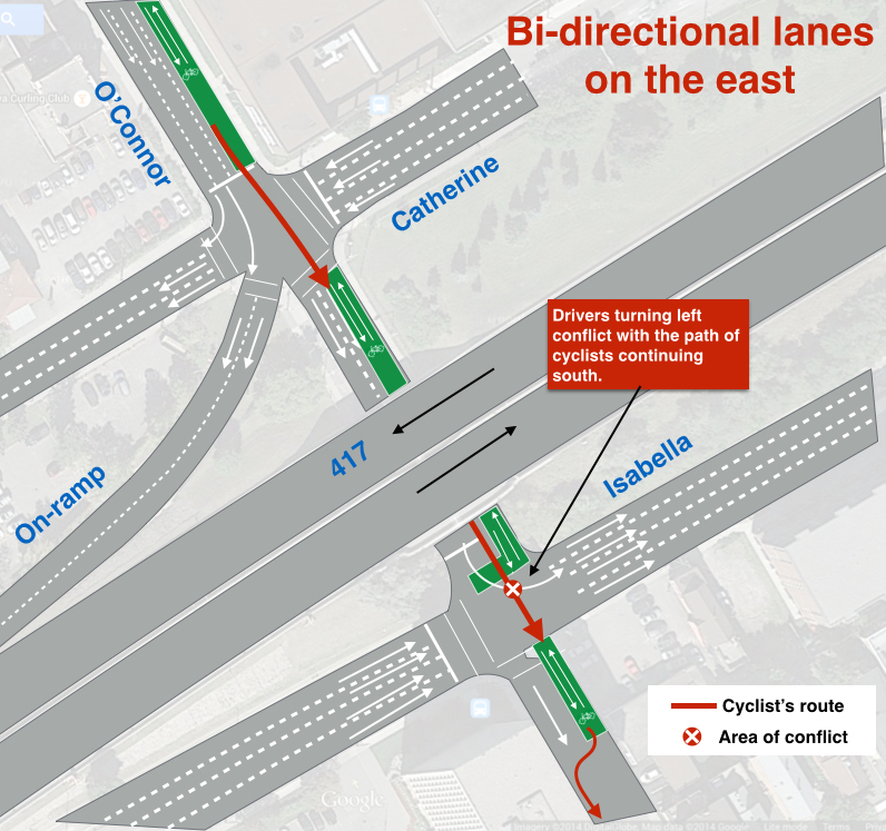
Keeping cyclists on the east side removes those conflicts. However, it also introduces a new problem: at Isabella, southbound cars turning east will be in the path of southbound cyclists (who would be in their blind spot). A bike box puts cyclists in front of motor vehicles for better visibility. It doesn’t eliminate the problem, but it’s a lot better than the current situation.
Of course, there’s lots of other considerations. Each intersection from Wellington down needs special consideration with signals and conflict zones. It’s not easy. Here’s a diagram that shows this:
But these are just predictions.