
Ottawa has many great bike paths along the canal, the Ottawa River and the Rideau River. One of the more underrated bike paths in the city is the Experimental Farm Pathway. It isn’t just great for recreation; it connects important parts of our community by an active transportation route.
To the east, it connects to the canal and Carleton University via Hartwell Locks. On the west end, it connects to Woodroffe and Centrepoint, which includes shopping outlets, Algonquin College, and other businesses. Unfortunately the pathway isn’t easy to reach by bicycle from many neighbourhoods to its north because they are separated by the 417 highway.
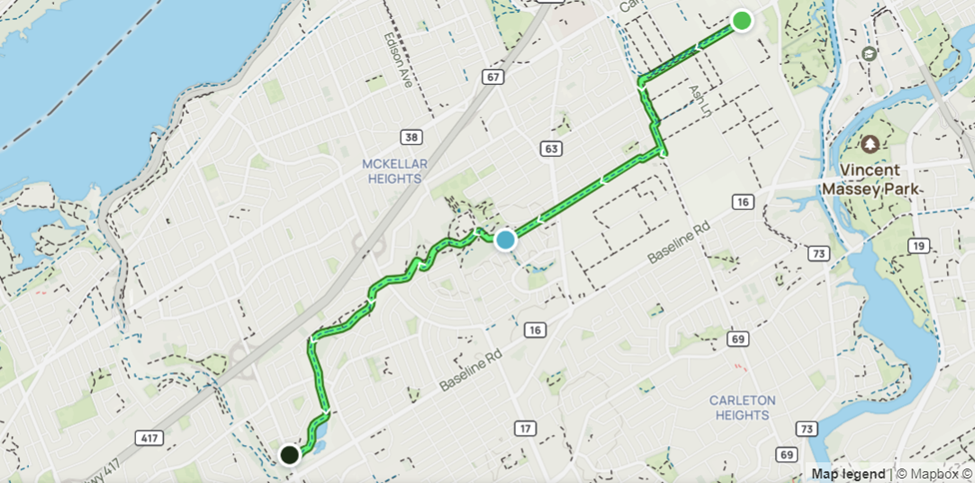
Recently it was announced that the Maitland Ave overpass, a bridge that is not bicycle friendly but connects communities north and south of the 417, will be replaced. The City requested active transportation facilities be implemented on the new overpass, and the Province agreed if the City paid up to $5.4 million to cover the costs of the cycling facilities. While it is not ideal to combine active transportation infrastructure and vehicles on a road like Maitland Rd, where speeds between the two modes of transportation differ drastically, these new bike paths will improve the cycling network by connecting the Experimental Farm Pathway to communities north of the 417. As someone who has cycled and driven along this stretch many times, I am both excited about this project, but I also have some issues with it.
Speed of the vehicles
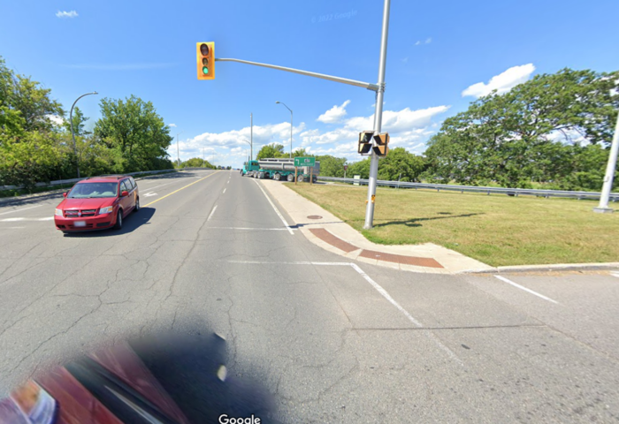
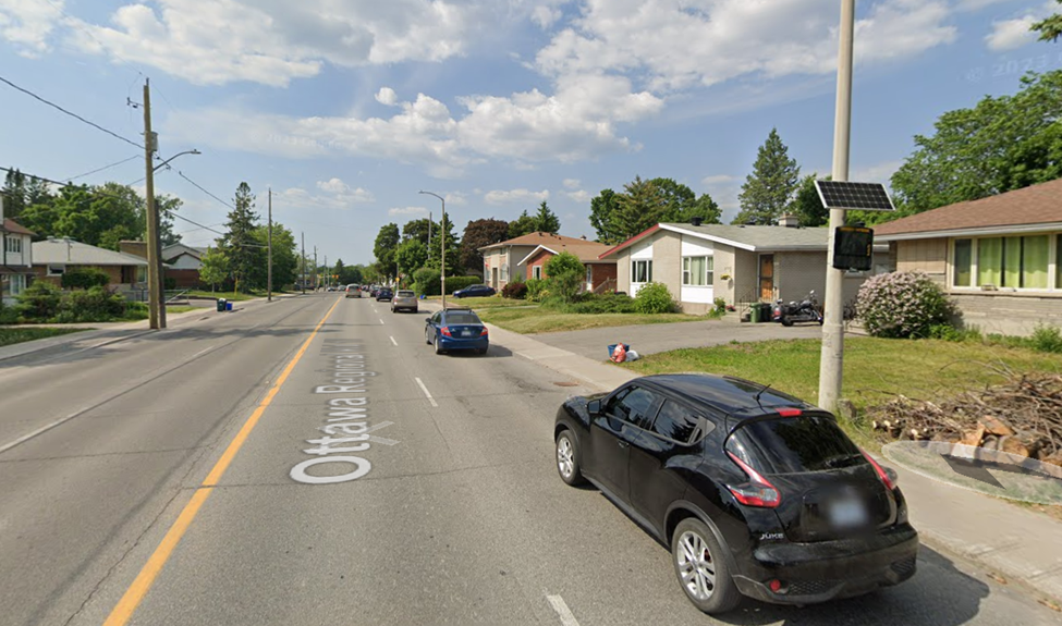
There are currently hills on either side of the bridge, since it goes up and over the 417. Vehicles naturally move faster while descending the bridge, but it seems many vehicles do not follow the speed limit. There is a speed display board further down on Maitland Ave, and when it works, it is frequently flashing red because many drivers exceed the 50km/h speed limit.
One might wonder why this is an issue, since the bike lanes and the vehicles will be separated. The area of my concern is at the conflict points: the on ramps and the off ramps north and south of the 417. At these intersections, there will be vehicles, who tend to exceed the speed limit along this stretch, crossing paths with active transportation users.
Design of the new bridge
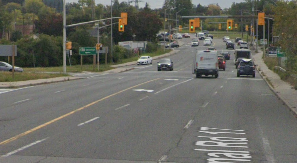
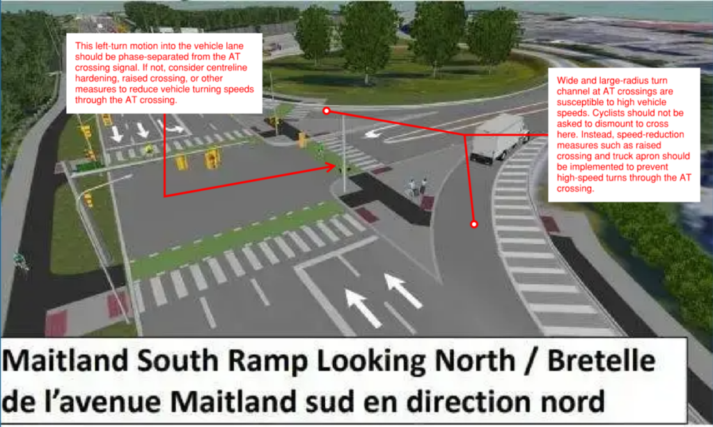
In addition, the new bridge will be widened so that the current left turning lane going southbound will extend the full length of the bridge. It currently begins just south of the bridge, closer to the intersection (as shown below). My concern here is again, speed of the vehicles. As a driver, I’d go into a turn faster if I had an extended lane to turn left compared to if I had to change lanes and then turn left, as drivers currently have to do.
Safety of Active Transportation Infrastructure Users
The City and Province are planning to implement active transportation infrastructure onto a road where vehicles already exceed speed limits. The new design also further allows vehicles to maintain speed, rather than slow down around conflict points where there will be vulnerable road users. What will be done with regard to the safety of the users of the active transportation infrastructure at conflict points?
I reached out to the project manager working for the Province about my concerns and the response I was given was that “it [will be] recommended that at the ramp intersection locations cyclists dismount and walk across the intersection” [sic]. This is a cop—out that manages to be ableist and more dangerous for cyclists at the same time, because they will be forced to spend more time in the conflict zone where drivers and cyclists must share space.
I requested additional design features to be added to slow traffic around the conflict points for the safety of the vulnerable road users. I was told that: “Any modifications to ramp configurations and intersections are not within the scope of this current project but will be done in conjunction with future MTO Highway 417 expansion work and/or future City of Ottawa projects on the municipal roads”.
Suggestions for Improvement
What kind of design features could be added to improve safety of the vulnerable road users? Here are some suggestions:
- The left turning lane going southbound should be traffic signal phase- separated from the active transportation crossing signal.
- The centreline could be hardened or there could be a raised crossing to reduce vehicle turning speeds
- Speed reduction measures at the slip lanes such as raised crossings and truck aprons should be implemented to reduce high speed turns through the active transportation crossings
Wider Impact of Safely Designed Active Transportation Infrastructure
My concern with the current plan isn’t just about safety, but also about user adoption rates. Research has shown that even small disruptions or unsafe stretches in network continuity can drastically reduce adoption rates.
In the wake of what the Mayor called a “financial crisis” associated with the public transportation system, one might think the City would have a broader vision to encourage commuters to use various ways to get to the new LRT stations when Phase 2 is complete. This project could be one small part of that plan to boost ridership. The bridge replacement is 2 kms from Cleary Station at Sherbourne Rd and Richmond Rd, and could safely connect cyclists who live south of the 417 to and from the Confederation Line.
If the City is to pay five million dollars to fund these bike lanes, they should be designed in a way that makes vulnerable road users feel safe, which will lead to higher adoption rates and a better use of taxpayer’s money.
Contribution by Bike Ottawa member Hollis Carlton.